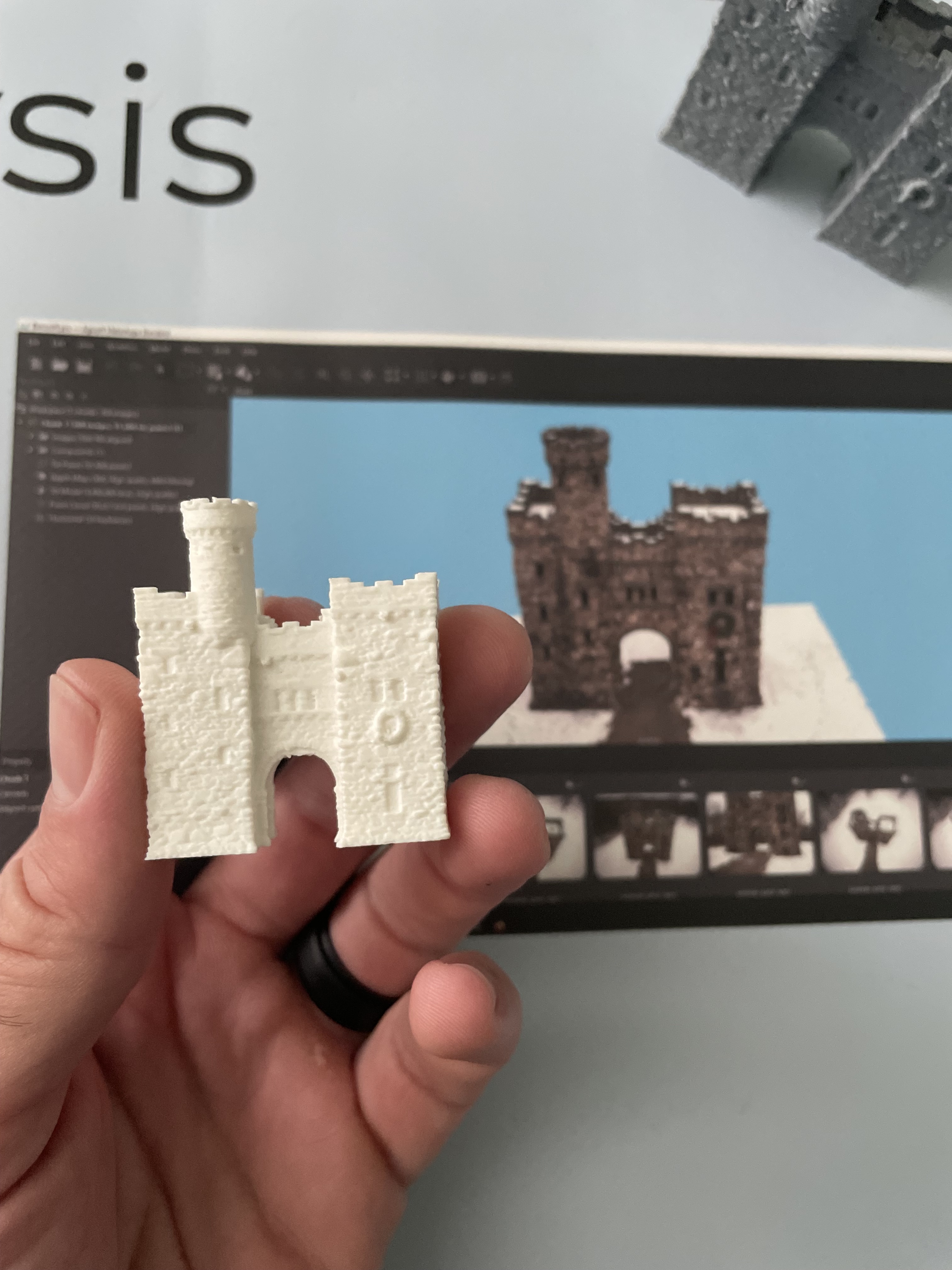
3D Services

Beyond simply capturing imagery, Eagle Eye Pictures is your one-stop shop for processing and analyzing photographic data to create visualizations for promotion, planning and assessment. The following renderings are an example of the kind of output that can be generated and used for any number of purposes, from construction site updates to 3D printed models. These are reduced-size files for ease of loading, the uncompressed models can be zoomed in to show incredible detail.

Gale Free Library, Holden MA
Bancroft Tower, Worcester MA

Interior & Exterior 3D Modeling & Floor Plans
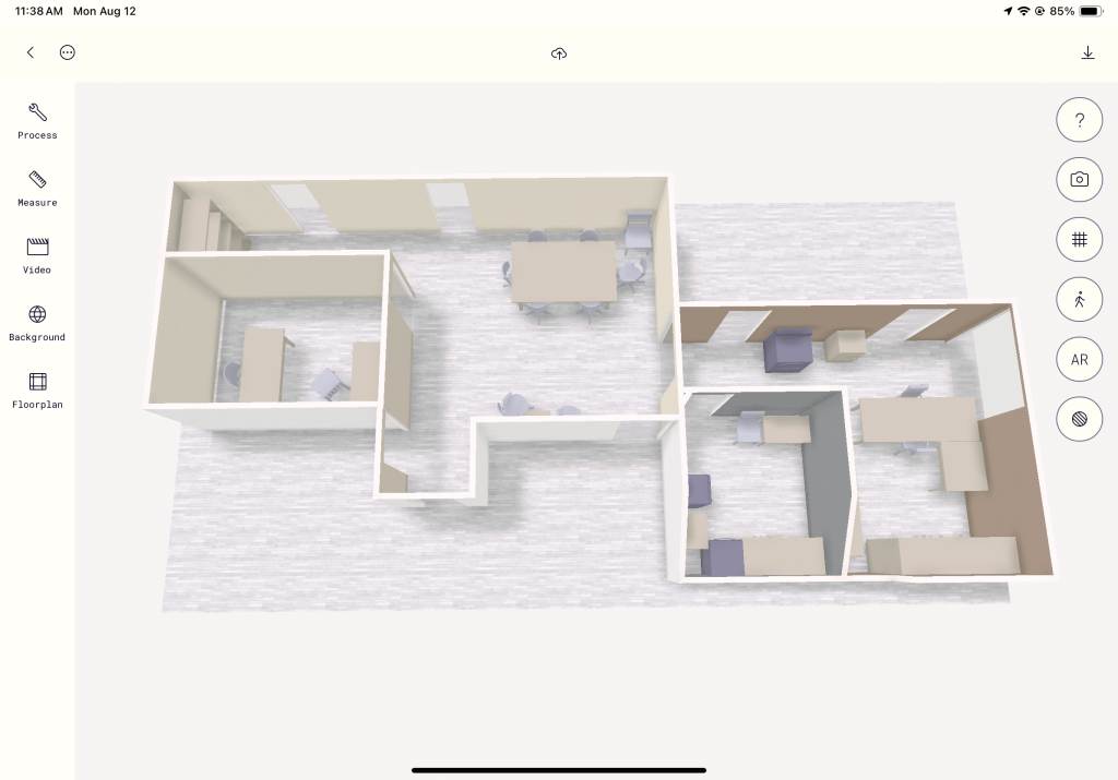
We can quickly model and measure anything from handheld objects to entire landscapes with the power of portable LiDAR and drone photogrammetry. Perfect for realtors, designers, developers, inspectors & other use cases.


Roofing & Solar Inspections

Conduct inspections from safely on ground level with high-definition live feed on an external monitor and a powerful optical zoom lens.


Tree Risk Assessment

Tree health and hazard assessment can be conducted quickly with the safety and convenience of a drone flight.


Soil Sampling

To truly understand a site, we also look beneath the surface. This is especially important to inform landscape design in highly developed areas. We offer immediate pH, drainage and compaction results, with further lab testing available.


Landscape Analysis & Design

After accurately capturing the detail of your landscape as it is, we can create a plan to improve ease of maintenance, biodiversity, soil fertility and homesteading potential. And we can show you how to get there over time, with detailed visuals.


Let’s create something together!

All photos & videos © 2017-2023 Seth Libby – All rights reserved